 ar
ar bg
bg hr
hr cs
cs da
da nl
nl fi
fi fr
fr de
de el
el hi
hi it
it ko
ko no
no pl
pl pt
pt ro
ro ru
ru es
es sv
sv tl
tl iw
iw id
id lv
lv lt
lt sr
sr sk
sk sl
sl uk
uk vi
vi et
et hu
hu th
th tr
tr fa
fa ms
ms hy
hy ka
ka ur
ur bn
bn mn
mn ta
ta kk
kk uz
uz ku
ku
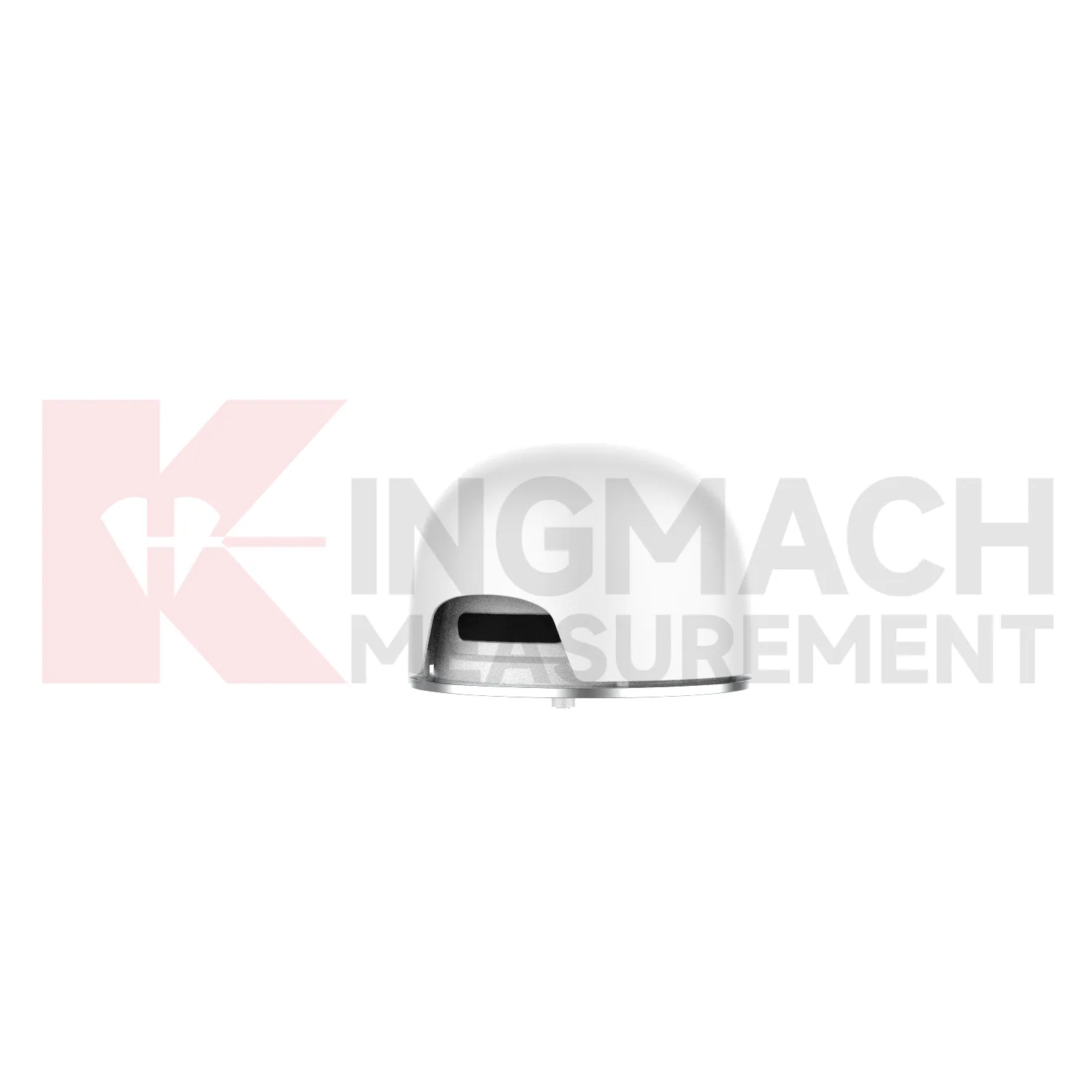
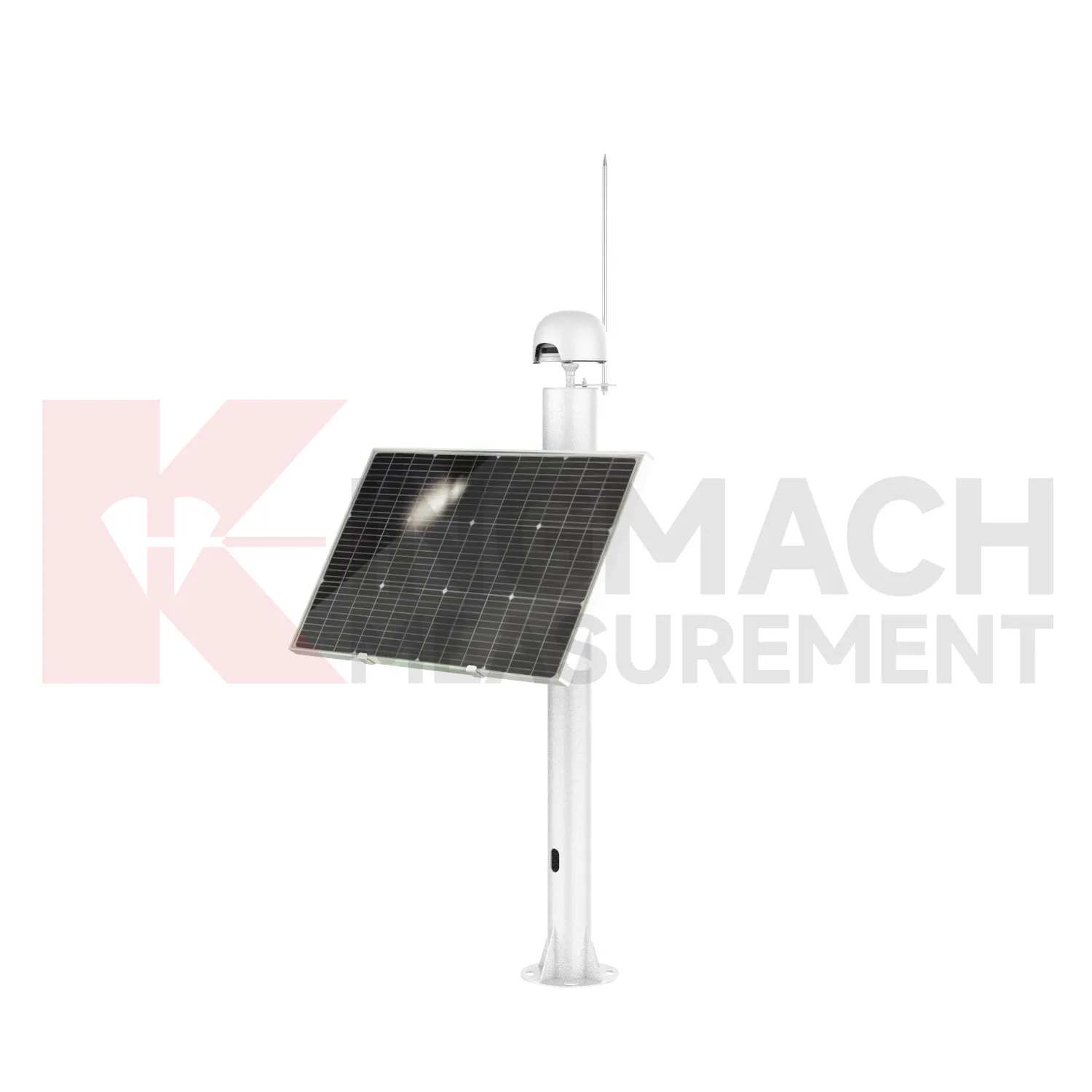
Integrated GNSS
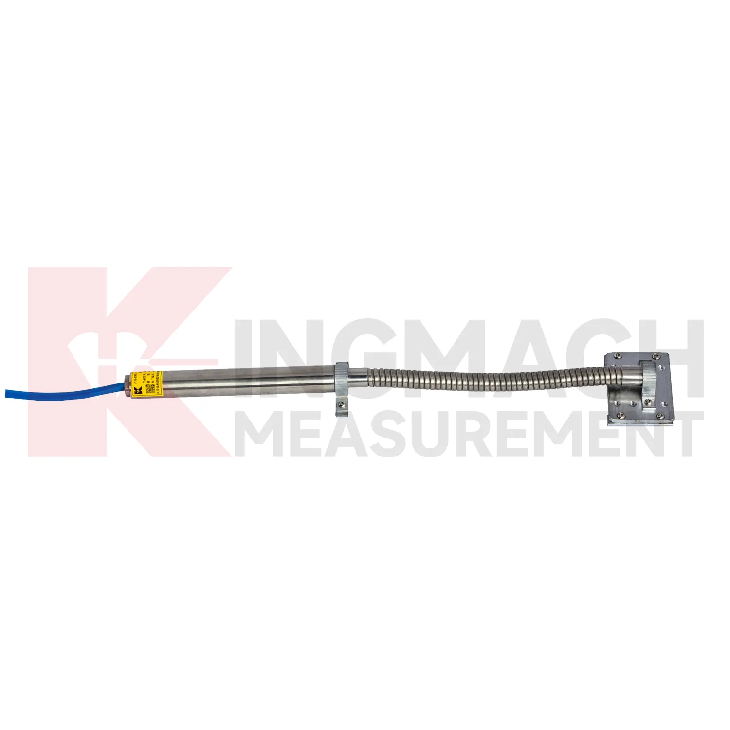
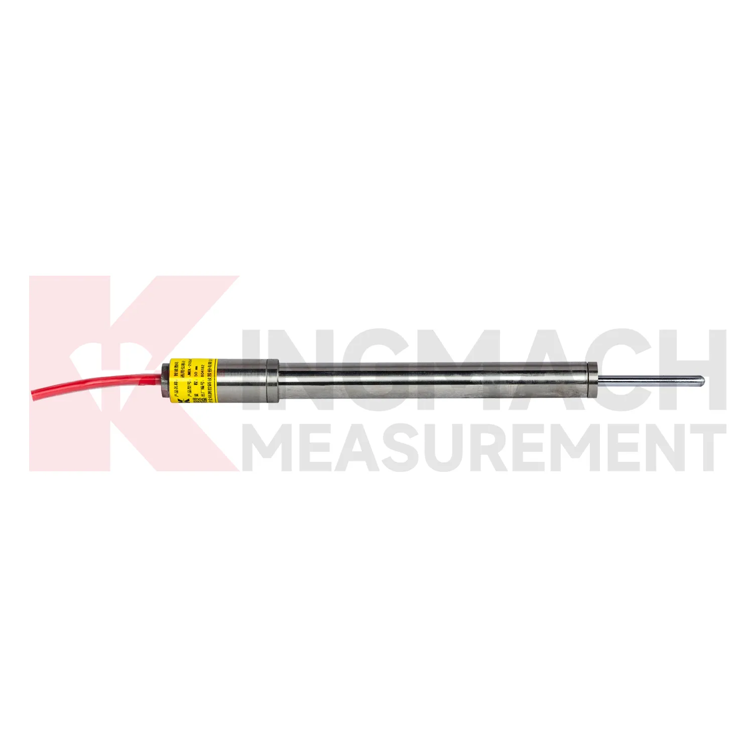
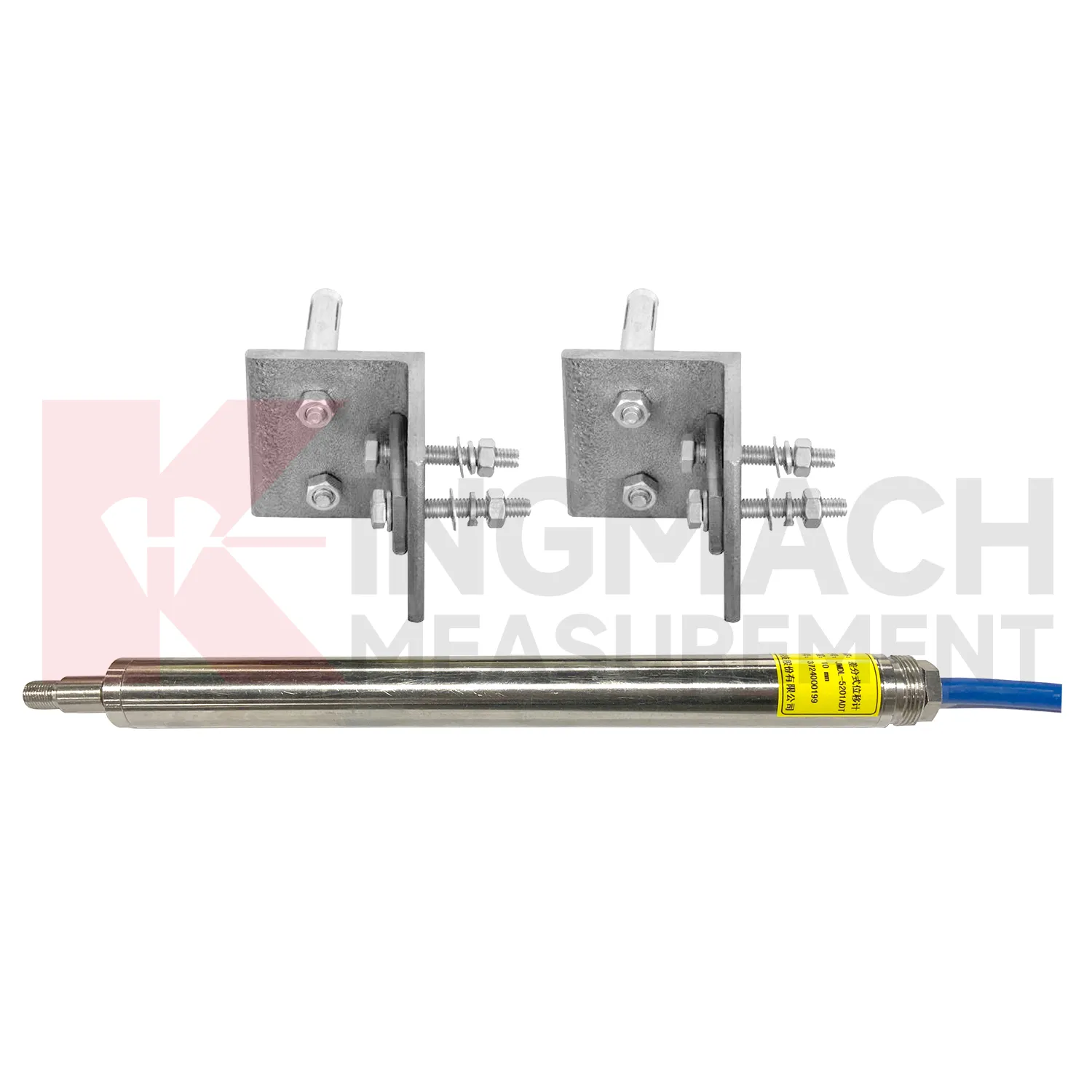
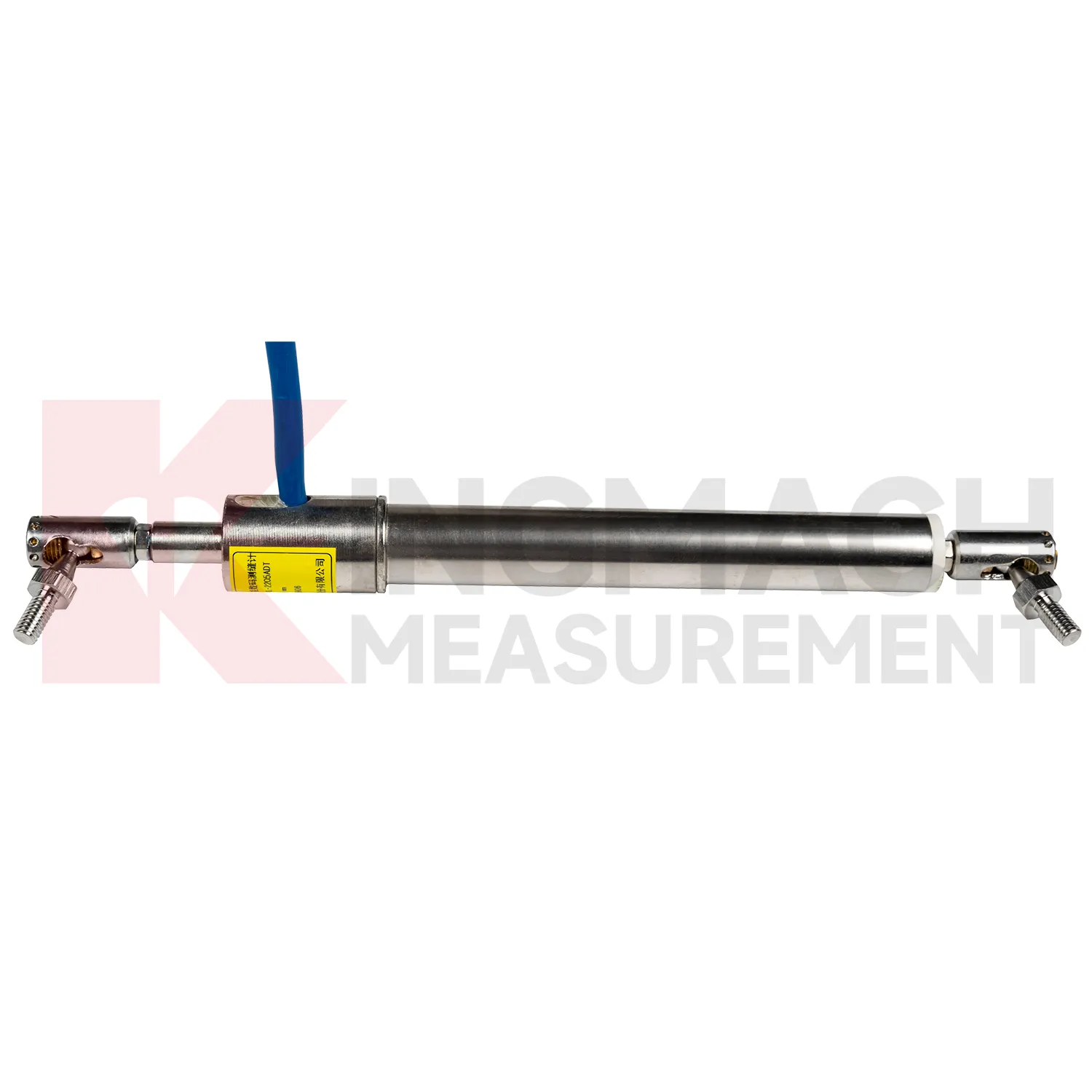
The JMLS-22XXADT Wire Rope Displacement Sensor broadens Kingmach Integrated GNSS into long-travel and flexible-path displacement measurement. It uses a retractable plastic-coated stainless steel cable wound around a spool and a precision rotary sensor. When the cable extends or retracts, resistance changes are converted into displacement data. Listed ranges include 0 to 500 mm, 0 to 1000 mm, and 0 to 2000 mm. Product information gives 0.1 mm resolution, 0.2%FS accuracy, DC 9V to 24V operating voltage, power consumption at or below 0.3 W, RS485 communication at 2400 bps, IP67 sealing, operating temperature from -30 degrees Celsius to +70 degrees Celsius, dimensions of 115 mm by 85 mm by 100 mm, and approximately 1 kg weight. The product supports linear and curved displacement monitoring, making it useful for dam monitoring, geohazard prevention, tunnel clearance, machinery position, soil and rock movement, and long-distance movement between two points. During project setup, the measuring point should be matched with the expected travel direction, available mounting space, cable route, and required acquisition interval. This prevents a short-range joint instrument from being used on a long-travel point, or an exposed sensor from being placed where an embedded anchor is needed. It also helps the monitoring team set a baseline that can be defended during acceptance and later maintenance review.
Application of Integrated GNSS
In slope and landslide monitoring, Integrated GNSS are used to detect surface creep, deep sliding, retaining wall movement, crack expansion, and displacement between fixed reference points. The challenge is that slope movement may be slow for weeks and then accelerate after rainfall, excavation, blasting, or traffic vibration. Kingmach JMDL-31XXAT multipoint meters can anchor several depths and separate shallow movement from deeper rock layer displacement. JMDL-32XXAT bedrock meters provide single-point embedded measurement with 50 mm, 100 mm, and 200 mm ranges, 0.01 mm resolution, 0.5%FS accuracy, and -30 degrees Celsius to +80 degrees Celsius operating temperature. JMLS-22XXADT wire rope sensors support 500 mm to 2000 mm movement paths with IP67 sealing. When these readings are reviewed with rainfall, pore pressure, tilt, and GNSS data, engineers can identify whether the slope is stable, creeping, or moving toward a warning threshold. During operation, the monitoring team should keep the baseline, temperature, inspection notes, and nearby sensor behavior in the same review file. This makes it easier to tell whether a movement trend comes from normal service, a repair event, changing load, water influence, or developing structural risk. Clear records also help owners decide when a field inspection is needed instead of waiting for visible damage.
The future of Integrated GNSS
The future of Integrated GNSS will put stronger emphasis on installation metadata. Many errors in displacement monitoring begin before the first reading: wrong range, poor bracket alignment, cable tension errors, unprotected connectors, zero readings taken during unstable loading, or channel names that do not match drawings. Kingmach smart displacement products store sensor data and measurement records, and future workflows can add digital installation forms, photos, QR codes, baseline checks, and automatic range verification. A field technician could scan the sensor, confirm whether it is a 50 mm, 100 mm, 200 mm, 1000 mm, or 2000 mm model, then bind it to the monitoring point. That small process improvement can prevent costly confusion months later, especially in projects with many cracks, joints, anchors, geogrid points, and rock-layer measurement depths. The strongest systems will still depend on careful installation, because digital tools cannot correct a loose bracket, wrong range, or poorly recorded baseline. Clear reporting will make displacement monitoring more useful for non-specialist decision makers while preserving the detail engineers need.
Care & Maintenance of Integrated GNSS
Care for Integrated GNSS starts with selecting the correct range before installation. A 20 mm or 50 mm joint sensor cannot replace a 1000 mm draw-wire sensor, and an embedded rock displacement meter cannot be treated like a surface crack gauge. Confirm model, range, resolution, accuracy, mounting accessories, cable length, power supply, output type, waterproof rating, and acquisition method before the instrument is shipped to site. For Kingmach products, check whether the selected model is JMDL-21XXAT, JMDL-22XXAT, JMDL-24XXAT, JMDL-31XXAT, JMDL-32XXAT, JMDL-49XXAT, JMDL-52XXADT, JMCW-21XXADT, or JMLS-22XXADT. During installation, record the zero reading only after brackets, anchors, measuring rods, cable pulls, or grouted points are stable. A rushed baseline can make every later reading harder to interpret, even when the sensor itself is working correctly. Keep the installation photo, point number, zero value, and expected movement direction with the commissioning record for later review. If a reading changes after maintenance work, inspect the base, anchor, cable, and cabinet before assuming the structure itself has moved.
Kingmach Integrated GNSS
Integrated GNSS give field teams a direct way to watch components that are hard to judge by sight. A formwork pipe may shift during pouring, a rock layer may slide behind the excavation face, a geogrid may deform inside reinforced soil, and a dam joint may open after water level change. Kingmach's product range includes non-contact designs where the measuring rod and coil work independently, reducing mechanical wear and installation damage. The JMDL-24XXAT flexible displacement meter uses a bendable measuring rod for geogrid monitoring, with 30 mm and 50 mm ranges, 0.01 mm sensitivity, and 0.5%FS accuracy. The JMDL-49XXAT formwork meter offers 50 mm, 100 mm, and 200 mm ranges, IP68 protection, and temperature measurement accuracy of plus or minus 0.5 degrees Celsius. These details are useful when displacement monitoring must continue through wet, crowded, and fast-moving construction stages. The point should be named on the drawing, linked with its cable route, and checked against the expected movement direction before the first automatic reading is accepted. For daily review, the reading should be compared with nearby points, recent weather, site operations, and any loading event that could explain the movement.
FAQ
Q: Which Integrated GNSS fit crack monitoring?
A: The JMDL-22XXAT Smart Crack Gauge is designed for cracks, joints, and expansion joints in bridges, buildings, roads, railways, dams, tunnels, and slopes.
Q: What ranges does the crack gauge list?
A: Listed models include 20 mm, 50 mm, 100 mm, and 200 mm ranges, with 0.01 mm resolution on the 20 mm to 100 mm versions and 0.05 mm on the 200 mm version.
Q: How many records can the crack gauge store?
A: Product information states that it can save up to 600 measurement results, including time, temperature for temperature versions, displacement values, and zero-point value.
Q: What installation details matter most?
A: Base stability, rod alignment, connector sealing, cable protection, and a clear zero reading matter more than a polished-looking installation.
Q: Can it be used for long-term observation?
A: Yes. The product is described for long-term monitoring, especially where crack width changes need stable and repeatable measurement.
Reviews
Robert Taylor
The weir flow meter is well-built and delivers accurate measurements. Great value for water management applications.
Andrew Lee
The visualization software is intuitive and powerful. It helps us analyze monitoring data efficiently.
Latest Inquiries
To protect the privacy of our buyers, only public service email domains like Gmail, Yahoo, and MSN will be displayed. Additionally, only a limited portion of the inquiry content will be shown.
Isabella***@gmail.comGermany
Hello, we are evaluating weir flow meters for a water management project. Please share accuracy deta...
Ava***@gmail.comAustralia
Hi, I am looking for reliable tiltmeters and accelerometers for structural health monitoring. Please...
Related product categories
- displacement sensor
- laser displacement sensor
- displacement sensors
- linear displacement sensor
- optical displacement sensor
- wireless displacement sensor
- laser displacement sensors
- non contact displacement sensor
- cable displacement sensor
- draw wire displacement sensor
- inductive displacement sensor
- lvdt displacement sensor